Over the past 20 years, the Mars Orbiter has taken a considerable number of photos Some speculate that the unusual network of ridges on Mars may hide unique clues to the history of the red planet However, there are still many unsolved mysteries about how these ridges were formed.
(from NASA / JPL / MSSS / Caltech Murray Lab / ESRI)
A team of scientists, led by Aditya khuller of Arizona State University's School of earth and space exploration and Laura KERBER of NASA's Jet Propulsion Laboratory, is in-depth analysis of the vast region of Mars through a project that has attracted thousands of science lovers.
Recently published in Icarus 》In an article in the journal, they pointed out that the ridges on Mars may hold fossil records of the flow of solid groundwater.
In fact, since the discovery of ridge networks in photos taken by orbiters, it has been a mystery how they formed on Mars.
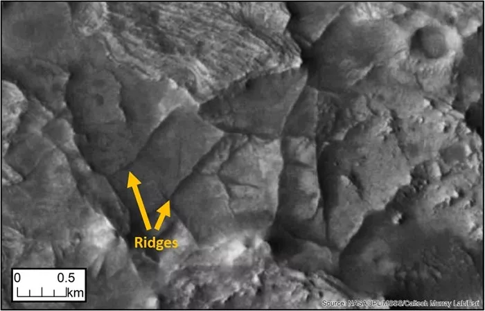
However, scientists have determined that ridge formation is mainly divided into three steps - the first is polygonal crack formation, the second is crack filling, and the final erosion stage.

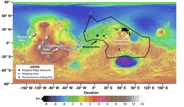
Black contour / polygonal ridge network, purple area / Mars rover perseverance landing site. (from NASA / JPL / GSFC)
In order to deeply understand these ridges, the research team combined the data of Themis camera onboard NASA Mars Odyssey orbiter and CTX and HiRISE instruments of Mars Reconnaissance Orbiter, and then distributed relevant tasks through Zooniverse crowdsourcing platform.
Nearly 14000 science enthusiasts from around the world joined the search for the Martian ridge network, focusing on the area around the Jezero crater, where the Mars rover perseverance landed last February.
With the support of the "people gather firewood" model, the research team finally mapped the distribution of 952 polygonal ridge networks, covering nearly one-fifth of the surface area of Mars.
Aditya khuller thanked: Science enthusiasts play an indispensable role in it, and almost anyone with networked computers can help based on the image mode of Mars.

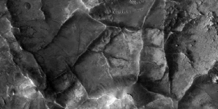
Polygon ridge network example
The results show that most of the analyzed ridge networks (864 / 952, accounting for 91%) are located in ancient eroded terrain with a history of nearly 4 billion years. During this period, Mars is considered to be warmer and wetter, and related factors are closely related to the formation of these ridges.
Previous studies have pointed out that those ridges not covered by dust show the spectral characteristics of clay. Since the clay is formed by weathering in the presence of water, it means that the relevant ridge is also formed under the action of groundwater.
In conclusion, the discovery will help scientists trace the water footprints under the ancient surface of Mars and determine where liquid water flowed through the planet during that period 4 billion years ago.
Looking ahead, the research team hopes to complete the mapping of the entire Martian ridge network with the help of more people. If all goes well, the exploration work of the Mars rover perseverance in 2020 may bring us greater surprises.

